Complete streets are streets which are designed, planned, constructed, and operated to enable safe use and support mobility for all users. They are for everyone regardless of age, ability, or mode of transportation.
By balancing the needs of different modes of transportation, Complete Streets enable numerous economic, health, safety, and environmental benefits. They create livable communities for a variety of different users and provide handicap-accessible transportation. Complete Streets also help to prevent motor accidents, cut unnecessary transportation costs, reduce pedestrian/bicyclist risks. Lastly, they improve public health by promoting physical activity through mobility.
Context-Sensitive Solutions
The appearance of a complete street varies depending on the community’s context. Complete Streets address elements such as sidewalks, bike lanes, special bus lanes, safe crossings, curb extensions, and more. The needs of a small rural town may not likely coincide with the traffic requirements of a large city, but through context-sensitive solutions, both can balance the safety and convenience for all roadway users.
Context-sensitive solutions are the facet of Complete Streets that help the street make sense to its community. This approach looks at how the design will affect the whole community. It creates a holistic design that enables the urban spaces to balance the safety and efficiency of their users. The design depends largely on the characteristics of their environment.
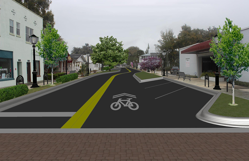 |
Historic Johnson Street Vision Plan, Hawthorne, FloridaThe Historic Johnson Street Downtown Vision Plan’s main objective was to revitalize Hawthorne’s downtown area from economic and social perspectives. This plan intends to facilitate economic development and market potential for future growth without compromising the City’s unique historic character. It will update the urban landscape through infrastructure redevelopment and beautification initiatives and encourage pedestrian and bicycle traffic. In addition, the plan will re-establish a sense of place, identity, and pride for the downtown area. The Johnson Street Vision Plan uses context-sensitive solutions to identify financially feasible street improvements that meet for the City of Hawthorne’s needs. |
Complete Streets in Our Communities
Over the last 30 years, CHW has engaged in a diverse project portfolio. Our work in both the private and public sector encompasses projects varying from one (1) square block streetscape design to miles of new roadway.
Our design process involves the collaboration of multiple disciplines, inclusive of certified land planners and urban designers, licensed land surveyors, civil engineers, transportation engineers, landscape architects, construction administrators, and construction engineering inspectors.
As with many other cities globally, complete streets are in demand in Gainesville. In the years 2005-2014, an average of four pedestrians per year died from traffic accidents in the Gainesville metropolitan area. Complete Street policies addressed this concern.
Gainesville has steadily implemented such policies through the reduction of lane widths, addition of bicycle lanes, installation of traffic circles, and more. Some examples include:
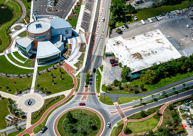 |
South Main StreetThe South Main street project features narrower roads, safer bike lanes, shaded sidewalks, crosswalks, and traffic calming measures such as street parking, lower speed limits, and medians. In addition, it moved utilities underground to improve the streetscape and connect sidewalks. The project consisted of roadway reconstruction, milling and resurfacing, drainage analysis, pavement design and review, and undergrounding electrical transmission, distribution lines, and communications utilities. Designing and permitting a project of this size consisted of coordinating with multiple design consultants as well as state and local agencies. This coordination helped address public concerns, utility design, hardscape, and landscaping. CHW provided land surveying, civil engineering, transportation engineering, and construction administration services for this project. |
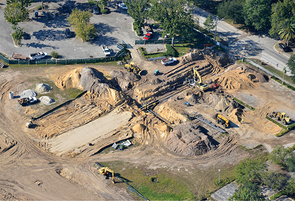 |
3rd AvenueThe 3rd Avenue project was designed concurrently with the 9th Street project to establish four quadrants within Innovation Square. The 3rd Avenue portion of the project consisted of 750 linear feet of road. It features an urban corridor including curb, landscape and hardscape zones, pedestrian zones, utility mains, and stormwater improvements. The majority of utility and other support infrastructure is located on 3rd Avenue to allow 9th Street to feature larger pedestrian zones that connect the north and south sides of the district. CHW provided land surveying, civil engineering, transportation engineering, and construction services for this project. |
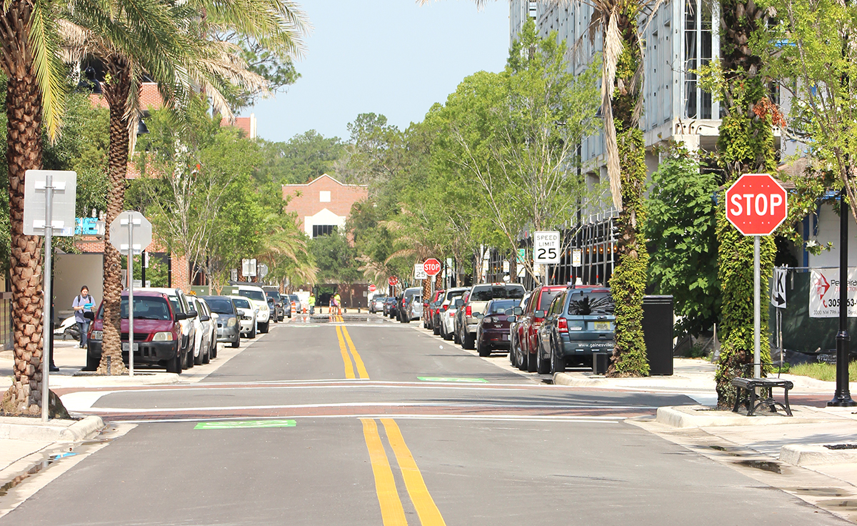 |
NW 1st AveNW 1st Avenue is a narrow corridor that runs parallel to W. University Avenue. Nicknamed “Dumpster Alley,” it lacked safe street parking and bike lanes, and featured utility poles and dumpsters that blocked sidewalks. Its location makes it a crucial roadway in the city as it houses key entrances to commercial and residential buildings. This project relocated utilities underground, improved sidewalks on both sides of the street, planted shade trees along the sidewalks, and increased parking and amenities. The NW 1st Avenue project measures ±2,000 linear feet and a has 50-foot-wide right-of-way. The project replaced water and sewer utilities within the roadway to provide updated and improved service to local customers. The extensive utility improvements within the project freed up space to allow for more pedestrian and streetscape improvements as well as landscaping enhancements. Construction was planned in a phased approach to minimize impact on businesses and visitors. |
